

Authors: Gavin Davidson, Emily Berry, Kayleigh Johnson, and Laurie C. Anderson, South Dakota School of Mines and Technology.
Grades: University-level paleontology or historical geology class; adaptable for high school science classes.
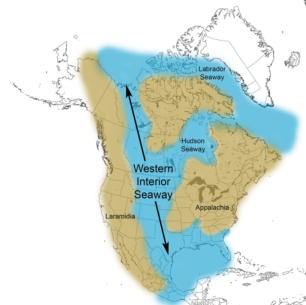
Description: During this lab you will learn how to interpret evidence from geologic maps and use it to reconstruct a feature from Earth’s geologic past: the Western Interior Seaway (WIS).
The Western Interior Seaway covered what is now the American Great Plains during most of the Cretaceous Period, from 113-66 Ma. But how do we know? Using geologic maps, we can infer which states contain sedimentary units from the WIS, and we can even approximate the boundaries of the seaway, which is what you’ll be doing today.
There are two versions of this exercise. One uses geologic data from the entire country to reconstruct the WIS. The other involves reconstructing the WIS using state-level geologic data.
Download files:
Country-level data: PDF (306 KB) Word (910 KB)
State-level data: PDF (1.1 MB) Word (8.9 MB)
Additional resources:
The Cretaceous Atlas of Ancient Life, including an overview of the geology of the WIS.